
Soubor:European Union Exclusive Economic Zones.PNG
Velikost tohoto náhledu: 767 × 600 pixelů. Jiná rozlišení: 307 × 240 pixelů | 614 × 480 pixelů | 982 × 768 pixelů | 1 280 × 1 001 pixelů | 2 560 × 2 002 pixelů | 4 572 × 3 576 pixelů.
Původní soubor (4 572 × 3 576 pixelů, velikost souboru: 1,65 MB, MIME typ: image/png)
| Tento soubor pochází z Wikimedia Commons. Níže jsou zobrazeny informace, které obsahuje jeho tamější stránka s popisem souboru. |
Popis
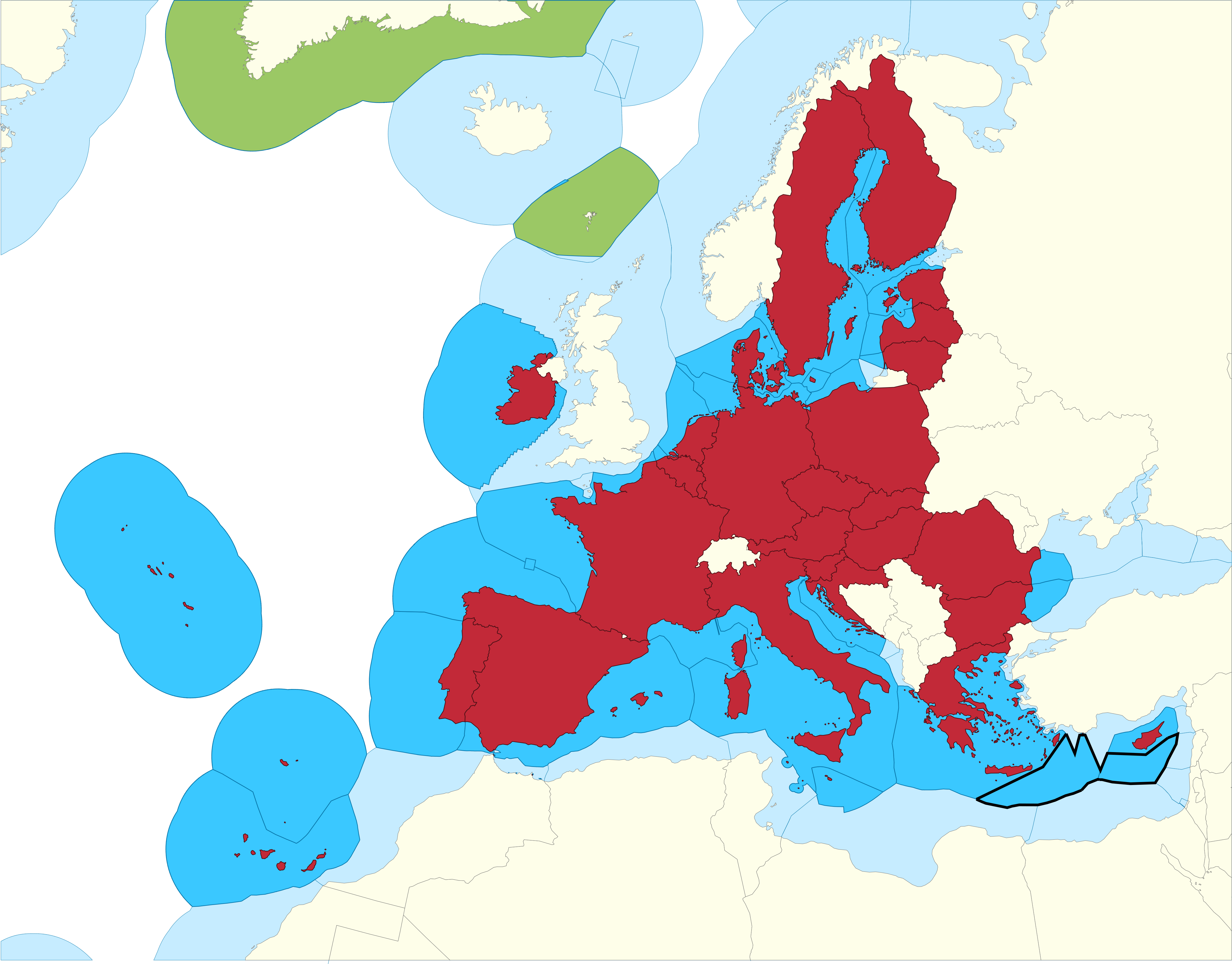
| Popis |
English: European Union Member states Exclusive Economic Zones |
|||
| Datum | ||||
| Zdroj |
EU member states Exclusive Economic Zones
EU member states overseas territories Exclusive Economic Zones
EU member states
Disputed Exclusive Economic Zones |
|||
| Autor | Sette-quattro, replacing the previous work done by Luis_wiki | |||
| Svolení (Užití tohoto souboru) |
Own work | |||
| Další verze |
|


Licence
| Já, autor tohoto díla, jej tímto uvolňuji jako volné dílo, a to celosvětově. V některých zemích to není podle zákona možné; v takovém případě: Poskytuji komukoli právo užívat toto dílo za libovolným účelem, a to bezpodmínečně s výjimkou podmínek vyžadovaných zákonem. |
Historie souboru
Kliknutím na datum a čas se zobrazí tehdejší verze souboru.
| Datum a čas | Náhled | Rozměry | Uživatel | Komentář | |
|---|---|---|---|---|---|
| současná | 17. 2. 2021, 13:14 | | 4 572 × 3 576 (1,65 MB) | Ahmetlii | higher resolution |
| 17. 2. 2021, 13:09 |  | 1 280 × 997 (308 KB) | Ahmetlii | added the disputed EEZ border per en:Cyprus–Turkey maritime zones dispute | |
| 8. 9. 2020, 23:33 |  | 4 572 × 3 566 (1,22 MB) | Sette-quattro | updated without UK, clearer boundaries | |
| 16. 7. 2011, 10:54 |  | 485 × 294 (86 KB) | Epipelagic | Somewhat simplified the map | |
| 23. 12. 2010, 13:12 |  | 489 × 298 (19 KB) | Begg maps | {{Information |Description={{es|1=-}} |Source=- |Author=- |Date=- |Permission= |other_versions= }} | |
| 28. 8. 2007, 01:31 |  | 489 × 298 (19 KB) | Luis wiki | {{Information |Description= European Union Member states Exclusive Economic Zones |Source= Own work over screen capture of Map Interface of VLIZ Maritime Boundaries Geodatabase (http://w2.vliz.be/vmdcdata/marbound/geointerface.php) |Date= 28 August 2007 |
Využití souboru
Tento soubor používá následující stránka:
Globální využití souboru
Tento soubor využívají následující wiki:
- Využití na ar.wikipedia.org
- Využití na ast.wikipedia.org
- Využití na ca.wikipedia.org
- Využití na en.wikipedia.org
- Využití na es.wikipedia.org
- Využití na eu.wikipedia.org
- Využití na fi.wikipedia.org
- Využití na he.wikipedia.org
- Využití na id.wikipedia.org
- Využití na it.wikipedia.org
- Využití na ja.wikipedia.org
- Využití na ko.wikipedia.org
- Využití na no.wikipedia.org
- Využití na pt.wikipedia.org
- Využití na sv.wikipedia.org
- Využití na uk.wikipedia.org
- Využití na zh.wikipedia.org